

The History of Easter Island

|
|
"In the middle of the Great Ocean, in a region where no one ever passes, there is a mysterious and isolated island; there is no land in the vicinity and, for more than eight hundred leagues in all directions, empty and moving vastness surrounds it. It is planted with tall, monstrous status, the work of some now - vanished race, and its past remains an enigma." Pierre Loti, L'Ile de Paques, 1872 |
Overview
Easter Island is a small triangular multi - volcanoed mound, roughly 14 miles long by seven miles wide. It lies 2,400 miles west of the coast of Chile and 2,500 miles east of Tahiti. Its closest human neighbors are 1,400 miles to the west on Pitcairn Island. The 2000 permanent inhabitants have the honor of being the remotest population on the face of the Earth.
Popular wisdom is that settlers first came from Polynesia and later from South America, though this is still fiercely debated. Regardless, one thing remains clear: they were an intelligent and artistic people who left a treasure trove of art and architecture that still fascinates man today.
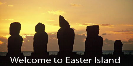
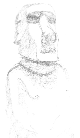
Moai average 12 to 25 feet in height. The largest known to have been transported to an ahu is 32 feet tall and weighs 50 tons. Over 240 ahu, built to honor the sprits of deceased relatives, snake along the coast. The moai associated with them all have their backs to the sea. Uniquely, the inland Ahu Akivi, on the long slope of the volcano Tereuaka, has seven moai facing the sea and is the only such occurrence on the island. An explanation for this disparity remains elusive.
Typically, the moai were carved out of volcanic ash, using hand picks of a teardrop design. The statues were cleverly carved from the rocks. First, the surface of the volcanic ash was made a little softer by moistening it with water. Then, using the hand picks, a line was pecked down until it was an inch deep. This was re-done about three-quarters of an inch over. This then produces two grooves with a keel in the middle. This keel could be then easily knocked out. By repeating this process, it is possible to carve out a figure in a much quicker time than you would expect. A wooden sled was then used to drag the statue to its proposed site and then erected by using a simple method of levers and rock piles. What seems an incredible - almost impossible - task is completed using very basic technology and skill.
The island is not only a testament to its peoples' sculpting skill, petroglyphs are also found throughout the island. The most impressive of these relief's are at the ancient ruins of the Orongo where a jumbled mass of rocks are covered with relief sculptures elaborating the rituals of the cult of the Birdman.
Civil war and ecological destruction ravaged most of the population. By the end of the 17th century, only a few of a once-vibrant and artistic people remained. Unanswered questions that cannot be ignored continue to haunt us: “Who were these people, isolated as they were, who developed an as yet un-deciphered written language, quarried stone, transported it for miles and erected statues upon burial tombs? “
The population of Easter Island reached its peak at perhaps 20,000, far exceeding the capabilities of the small island's ecosystem. Resources became scarce, and the once lush palm forests were destroyed, cleared for agriculture and possibly for moving the massive stone moai. Thereafter, a thriving and advanced social order began to decline into bloody civil war, perhaps even cannibalism. Before the Dutch Admiral, Jacob Roggeveen, “discovered” and named Easter Island in 1722, islanders had torn down most of the moai. Those that remained standing were evidently flattened by a tidal wave (insert approx date here). All of the statues now erect are the result of archaeological efforts.
Later contacts with western "civilisation" proved disastrous for the island inhabitants. Due to slavery and disease, the population decreased to approximately 111 by the turn of the century. Following the annexation by Chile in 1888, however, this number has risen to more than 2,000, with other Rapa Nui living in Chile, Tahiti and North America. Despite a growing Chilean presence, the island's Polynesian identity is still quite strong.
First contact
With his three ships, “Eagles”, “Thienhoven” and the “African Galley”(?), the Dutch Admiral Jacob Roggeveen went in search of the “Southern Continent”. Until prevented by ice, he managed to make the southerly latitude of 60 degrees.
With this, he turned his ships towards the Juan Fernandez Islands thinking that there might be an opportunity to found a settlement. On April 6th, 1722, his westerly course brought him to a lonely island. As it was Easter, he baptized the island “Easter Island”.
Another account suggests that Roggeveen was in search of Davis or David’s Island. Reported in latitude 27o by and Englishman buccaneer named Davis, in 1687. He claimed that it was five hundred miles from the coast of Chile, low and sandy and some 12 leagues to the west of it was seen “a long tract of pretty high land”. This description in no way applies to Easter Island, as sometimes suggested, but is possibly a description of Crescent Island. The latitude of Easter Island is 27o 8’S, Crescent Island is 23o 20’S. Roggeveen concluded this was not the island he was looking for2.
Due to strong surf and no readily suitable anchorage, he lay off the north coast for a week and was only able to make landfall once. The landing party gave descriptions of an island with no large trees, a rich soil, sugar-cane, bananas and figs. Current scientific thought suggests that these descriptions may have been somewhat inaccurate. Roggeveen made contact with the indigenous population. Roggeveen wrote that “when these (page 201) and admired the large stone statues that dotted the landscape.
After departing Easter Island, Roggeveen was to discover some islands of the Tuamotu group. He visited Takapoto, Makatea and Samoa where his fleet were to rest for sometime before continuing on to Batavia in September 1722.
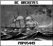
H.M.S Topaz
 In 1868, the Mar of War H.M.S. Topaz visited Easter Island and remove a moai to be subsequently presented to Queen Victoria, It took 200 people to drag Hoa Haka Nana Ia (Lost Friend), made between 11th and 17th centuries, to the Topaze. Hoa Haka Nana Ia now resides in the Queen Elizabeth II Great Court at the British Museum in London.
In April of 1856, the British ship Denmark was abandoned in a sinking condition after a long battle against severe storms off the Falkland Islands. Her crew of 17 were picked up by H.M.S. Topaze and carried into Stanley.
Race Rock Lighthouse in British Colombia, Canada, was built by the crew of HMS Topaz and outside laborers under a contract awarded to John Morris.
Three days prior to the official operating date for the lighthouse (December 25, 1860) the Nanette, a British vessel carrying sawmill machinery and Hudson's Bay Company merchandise, ran into thick fog by early evening and was swept up by the swift tide along the shoals. Early the next morning the Nanette was thrown against the rock by a seven-knot tide and the vessel began to sink. The salvage operation became difficult when news of the cargo's value (estimated $200,000) spread, attracting many looters, and requiring officers and sailors to police the area. Further salvage of the vessel came to a stop in 1861 when the Nanette was swept to the depth of 15 fathoms in foul weather.
(http://mmbc.bc.ca/source/lighthouse/racerock.html)
There was also something about her crew piping the opening of a Masonic Lodge in Canada.
Wasn't it Topaz that left the plaque on Robinson Crusoe island?
Environment
Rapa Nui is a barren island, but this was not always the case. Studies of pollen cores prove that the first Polynesian settlers found an island paradise of lush, subtropical forest6. Within 400 years of colonization, deforestation was well underway5.
700 years after colonization, the forests were gone, every species of land bird was extinct and shellfish were overexploited. Without trees, the inhabitants could no longer make sea faring canoes with which to hunt porpoises, the main staple of their die.
Without sea faring ability, Rapa Nui became a closed system. The inhabitants could not abandon the island and turned to intensive poultry production Rats also became a dietary staple.Without wood to burn for cooking and heating fires, sugarcane scraps, grass and sedges were used instead, which in turn impoverished the soil. The population crash happened about 200 years later. In 1722, Jacob Roggeveen found barren grassland, a landscape devoid of trees and shrubs. Botanists have since identified only 47 species of plants, two shrubs and two tree types. Rapa Nui is 64 square miles with a carrying capacity of 2000 persons, about one-tenth of what is considered to be its peak population6.
One of the tree types, the toromiro, used to grow in great numbers on Rapa Nui. It is a small leguminous tree with yellow flowers. Its beautiful and resistant wood was used for making, among other things, the famous moai 'kava kava'.
At the time Thor Heyerdahl visited Rapa Nui in 1956, there was apparently but one, very sick, toromiro left. Found by Thor at the base of the Rano Koa crater, he removed a single living branch bearing seed-filled pods and had it delivered to Professor Selling, who in turn took them to the Botanical Garden of Gotebourg.
By 1980, there were two toromiro plants alive in Gotebourg and it was decided to attempt to reintroduce the plant to Rapa Nui. This and a second attempt in 1988 resulted in failure, due to a root nematode that killed all the seedlings.
As of 1995 there are still no well-established toromiros on Rapa Nui and all the samples originate from just one tree. However, all is not lost, in 1994 four European botanic gardens, including the Royal Botanic Gardens in Kew, set up a special Toromiro Management Group to co-operate in the reintroduction project and the enlarging of the dangerously low gene pool of Rapa Nui toromiro.
History overview
From first European contact.
| 1722 | Easter Sunday. Admiral Jacob Roggeveen (Dutch) |
| 1770 | Gonzalez (Spanish) |
| 1774 | James Cook (British) |
| 1786 | La Perouse (French) Occasional visits from passing ships |
| 1859 – 1862 | Peruvian slave trades take in excess of 1000 islanders to work on the Peruvian Guano trade |
| 1864 | (Jan.) Arrival of first missionary from Valparaiso |
| 1867 | Commercial exploitation begins with the arrival from Tahiti of M. Dutrou Bornier. Subsequently murdered by the local population who claimed he “fell from a horse”. |
| 1868 | H.M.S. Topaze removes statue (Hoa Haka Nana Ia), later presenting it to Queen Victoria. Held within the Queen Elizabeth II Great Court, at the British Museum, London. |
| 1872 | Pierre Loti, L'Ile de Paques visits the island. |
| 1888 | Visit by the American warship Mohican Annexed by Chile |
| 1897 | Mr. Merlot of Valparaiso leases the greater part of the Island and subsequently form a company for the “Exploitation of Easter Island”. |
| 1914 | Katherine Routeledge visits for a yearlong expedition to the island. Publishes the book “The Mystery of Easter Island” in 1919 |
| until 1952 | Leased to private companies (some British influence?) |
Piths & Particulars
Moai
Approximately 600 moai on the island.
Caves and petroglyphs
Volcanoes
there are three volcanoes on the island, all extinct.
Moai Quarry
Fire trench
Anthropological museum – Hanga Roa
British Museum London
The moai Stolen Friend a.k.a. Hoa Haka Nana Ia, taken by H.M.S. Topaze. Housed in the Museum of Mankind until the late 1990’s, moved to the Queen Elizabeth II Great Court within the British Museum, London, in 2000.
People
Admiral Jacob Roggeveen, 1659 – 1729
Discovered Easter Island during a failed search for the “Southern Continent”.
Katherine Routledge, xx – xx
Stewardess of the Mana expedition to Easter Island. Feb 1913 – June 1916
Thor Heyerdahl, xx - xx
Explorer and proponent of the theory that Easter Island was settled from South America.
Reading
1. Chile Handbook 2nd Edition, 1999, Charlie Nurse, Footprint Handbooks, ISBN 0-8442-2127-9
2. Routledge, Katherine: The Mystery of Easter Island. Adventures Unlimited Press, 1919 ISBN 0-932813-48-8
3. Easter Island: An International Travel Map, 2nd Edition. ITMB Publishing Ltd, 1998 ISBN 0-921463-30-8
4. Heyerdahl, Thor: Aku Aku, the secret of the Osterinsel. Berlin, 1957
5. Pleticha, h/recorder, H.: The discovery of the world. Vienna, 1993
6. Diamond, Jared: Easter's End. Discovery, 1955 (August issue).