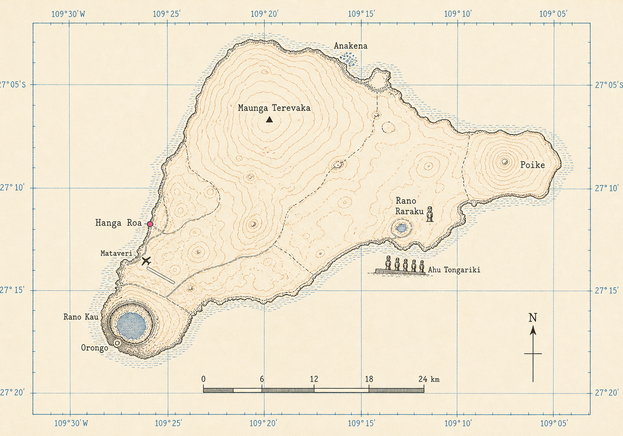
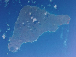
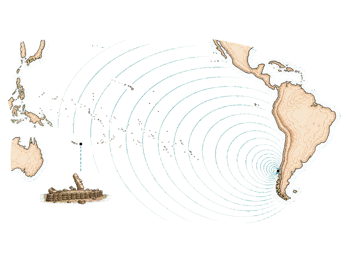
Travel · Sheet 45-RAP · Rapa Nui · 27.1° S, 109.4° W · 3,700 km from Chile
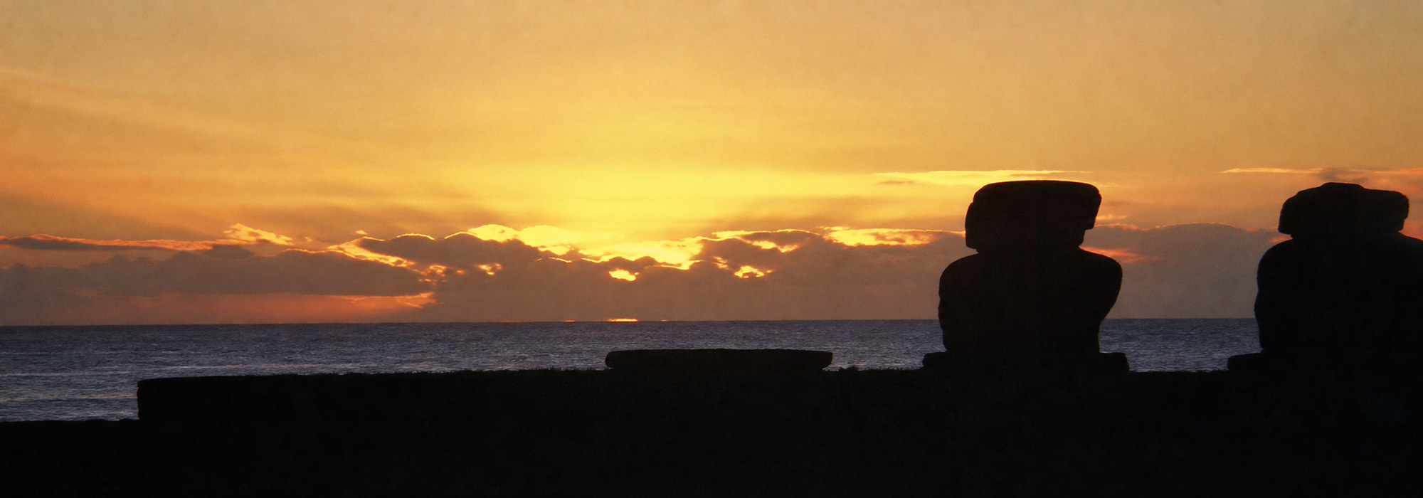
The land of giants.
I have been fascinated with Easter Island since childhood, when I first saw pictures of stranded moai on the face of Rano Raraku. In the autumn of 2001 I finally made the journey, half way around the world, and found that everything I knew about Easter Island was a lie.
- Filed under
- Travel · Destinations
- Reference
- REF 45-RAP
- Visited
- Nine days, autumn 2001
- By
- Seamus Waldron
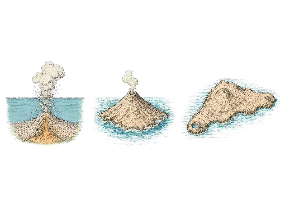
An island is born
Fire, forest, and what happened to both
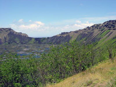
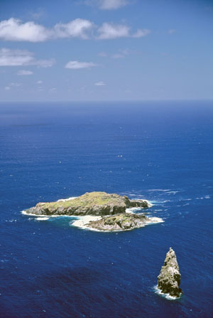
We can all too easily forget how a place comes into being. Rapa Nui is a child born out of the fiery belly of the earth itself.
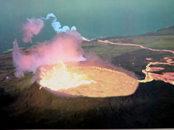
In the fantastic time-scale of planetary evolution, all volcanic islands are likely to be transitory. The birth and growth of Rapa Nui might have been spectacularly rapid; its decline through the long process of erosion being so slow as to be virtually imperceptible.
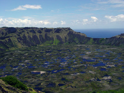
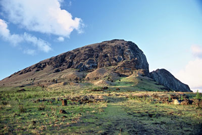
The first eruption forming the first land of Rapa Nui might have left in its wake a raised cone of land with a bowl-shaped depression, the crater, at the top of the conduit. Later, other eruptions would have formed small cones and two other larger craters. Finally the three main volcanoes and the many smaller cones would have created a complete landmass of 69 miles square.
Gradually, after all the volcanic activity had ceased, rain would have filled the remaining craters.
The island of Rapa Nui was born.
The environment
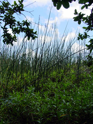
Rapa Nui is a barren island, but this was not always the case. Studies of pollen cores prove that the first Polynesian settlers found an island paradise of lush, subtropical forest. Within 400 years of colonization, deforestation was well underway.
700 years after colonization, the forests were gone, every species of land bird was extinct and shellfish were overexploited. Without trees, the inhabitants could no longer make sea faring canoes with which to hunt porpoises, the main staple of their diet.
Without the population lacking sea faring ability, Rapa Nui became a closed system. The inhabitants could not abandon the island and turned to intensive poultry production; rats also became a dietary staple.
Without wood to burn for cooking and heating fires, sugarcane scraps, grass and sedges were used instead, which in turn impoverished the soil. The population crash happened about 200 years later. In 1722, Jacob Roggeveen found barren grassland, a landscape devoid of trees and shrubs. Botanists have since identified only 47 species of plants, two shrubs and two tree types. In recent years, the accidental introduction of the thistle to the island could become a serious problem.
Trees, in general, are beginning to return to the landscape. Rana Kao is now covered with trees and Rano Raraku has trees at its base. Although there is a long way to go, you could not say that Easter Island is tree-less. There are other plants that are new introductions which are beginning to find the climate nurturing. The thistle, common in Scotland, is now becoming a nuisance on the island, unfortunately there appears to be little awareness of the severity of an island full of thistles.
First contact
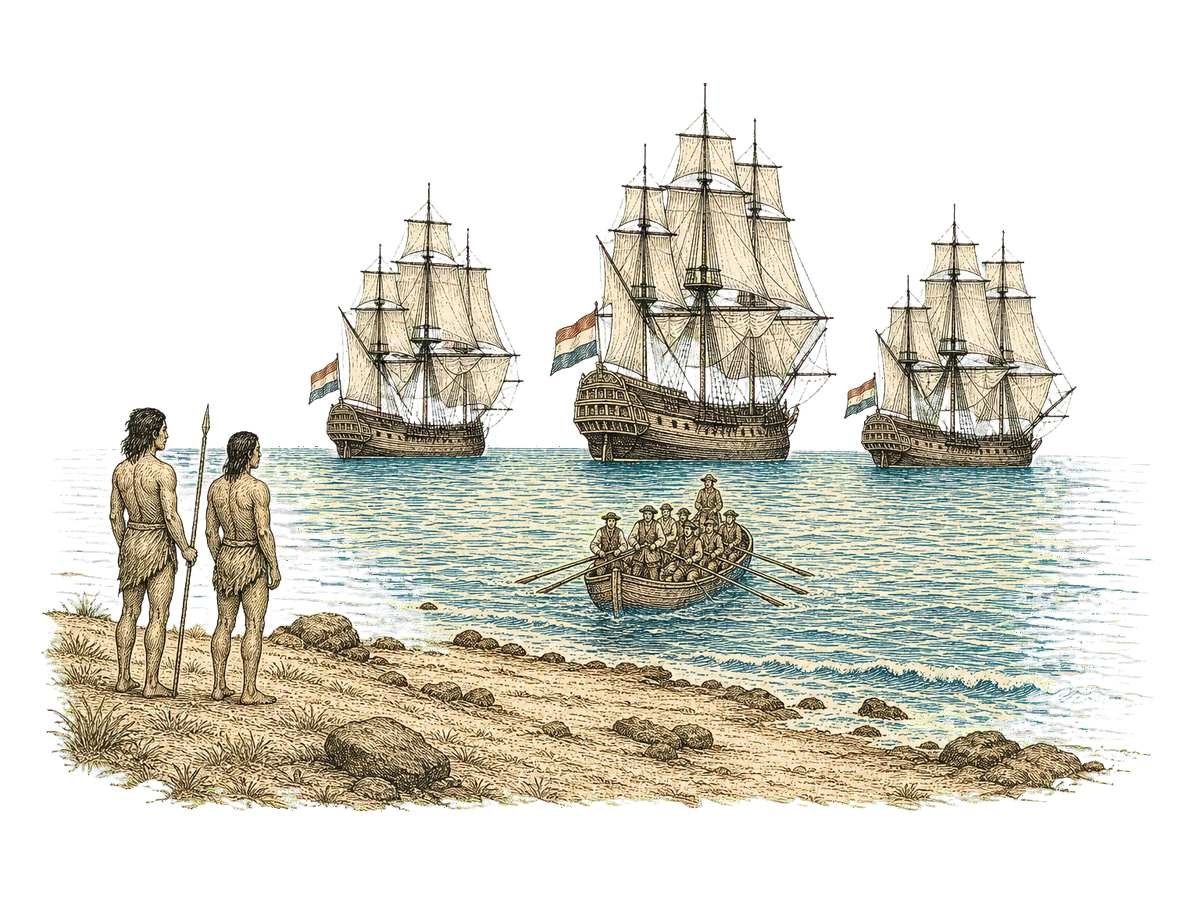
An Easter Sunday in 1722, and what Europe took away
With his three ships, "Eagles", "Thienhoven" and the "African Galley", the Dutch Admiral, Jacob Roggeveen (1659 - 1729), went in search of the "Southern Continent" in August 1721. Until his southerly travels were prevented by ice floes, he managed to make the latitude of 60°.
With this, he turned his ships west towards the Juan Fernandez Islands thinking that there might be an opportunity to found a settlement. On April 6th, 1722, his course brought him to a lonely island. As it was Easter, he baptized the island "Easter Island".
Another account suggests that Roggeveen was in search of Davis or David's Island. Reported in latitude 27° by an English buccaneer named Davis, in 1687. He claimed that it was five hundred miles from the coast of Chile, low and sandy and some 12 leagues to the west of it was seen "a long tract of pretty high land". This description in no way applies to Easter Island, as sometimes suggested, but is possibly a description of Crescent Island. The latitude of Easter Island is 27° 8'S, Crescent Island is 23° 20'S. Roggeveen concluded this was not the island he was looking for.
Due to strong surf and no readily suitable anchorage, he lay off the north coast for a week and was only able to make landfall once. The landing party gave descriptions of an island with no large trees, a rich soil, sugar-cane, bananas and figs. Current scientific thought suggests that these descriptions may have been somewhat inaccurate. Roggeveen made contact with the indigenous population and admired the large stone statues that dotted the landscape.
After departing Easter Island, Roggeveen was to discover some islands of the Tuamotu group. He visited Takapoto, Makatea and Samoa, where his fleet were to rest for sometime before continuing on to Batavia in September 1722.
More on Jacob Roggeveen, a busy life
Before he 'discovered' Easter Island, Jacob Roggeveen had already lived a busy life. He became notary of Middelburg on 30 March 1683. On 12 August 1690 he graduated as a doctor of the law at University of Harderwijk, and worked between 1707 and 1714 as a Raadsheer van Justitie ("Council Lord of Justice") at Batavia, Dutch East Indies (now Jakarta). In 1715, he returned to Middelburg.
There he got into trouble because he supported the liberal preacher Pontiaan van Hattem by publishing his leaflet De val van 's werelds afgod. The first part appeared in 1718, in Middelburg, and was subsequently confiscated by the city council and burned. Roggeveen fled Middelburg, and later Vlissingen. Thereafter he established himself in Arnemuiden, and published part 2 and 3 of the series, again raising a controversy.
Whilst in Samoa after departing Easter Island, he was arrested because he had violated the monopoly of the Dutch East India Company, but the Company was later forced to release him, to compensate him for the trouble, and to pay his crew. In 1723, Roggeveen returned to the Netherlands. After his return Roggeveen published part 4 of De val van 's werelds afgod.
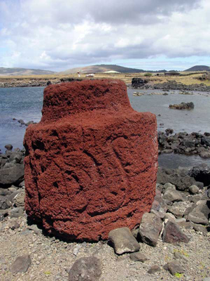
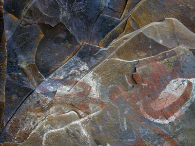
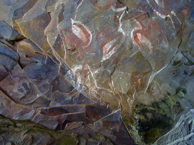
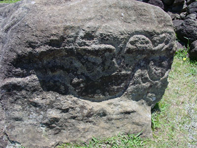
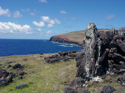
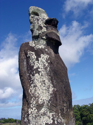
The stolen moai
There hare many statues around the world that were taken from Easter Island. The most well known is Hoa Hakanani'a, originally translated as Braking Waves, but a more accurate later translation is Stolen or Hidden Friend.
In 1868, the British Man of War H.M.S. Topaz visited Easter Island and removed two moai. Two hundred people were needed to remove Moai Hoa Hakanani'a from the ceremonial village of Orongo, atop the volcano Rano Kao, to the ship. Moai Hava was removed from the general environs of the village of Hanga Roa.
During the voyage to England, the red and white paint adorning the intricate carving of Hoa Hakanani'a was leeched away by water. Nether the less it was presented to Queen Victoria, and the Moai Hava was presented directly to the British Museum. Queen Victoria later gave Hoa Hakanani'a to the British Museum, where it now stands in the magnificent Queen Elizabeth II Great Court.
Hoa Hakanani'a was made about AD 1000 and is an exceptionally well-preserved example of the stone masonry and artistic capabilities of the indigenous population. It is likely that this moai was created during the crossover period between the statue building era and the Birdman-cult. It is commonly stated that all the moai were carved from the volcanic tuft of Rano Raraku, however, Hoa Hakanani'a and its partner at the British Museum were carved from a quarry local to Hanga Roa.
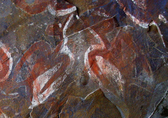
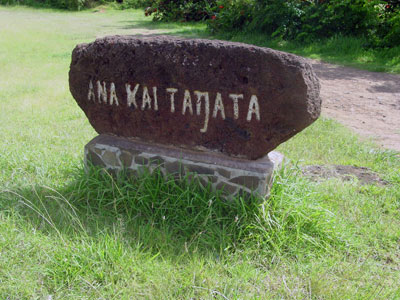
It is suggested that Hoa Hakanani'a, quite a small stature at only 1.5 tons, was taken from an ahu and moved to the ceremonial village of Orongo where the back was later painted and intricately carved with symbols of the birdman-cult. It is likely that the colours used would resemble the pictoglyphs found in the cave Ana Kai Tangata.
Religion on Easter Island went through several pahses, from ancestor worship, through to the birdman cult and finally Christianity. The original site marked this chapter "to be completed", and so it remains: a case still under preparation.
Rongorongo
The unreadable library
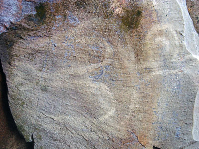
Just as much an unknown as the moai, rongorongo is the name given to the hieroglyph script found on wooden tablets. In 1864, Eugene Eyraud, the French lay missionary, reported that "all the houses" he had seen hundreds of these tablets and hieroglyph incised staffs. Four years later and following the death of Eyraud, missionaries could find little evidence of these tablets and staffs. They had been burnt, hidden in caves, cannabalised for planking in fishing boats or for other uses. The once sacred state of these tablets was no longer feared by the population.
Steven Fischer, a researcher and former lecturer at Canterbury University, New Zealand, gives us this description of the script of Easter Island.
"Most of Rapa Nui's rongorongo inscriptions consist of parallel lines of signs or glyphs that represent human figures, birds, fishes, plants, geometrics, and other things. These fingernail-size glyphs were traditionally incised on large battle staffs, driftwood tablets, small wooden "Birdmen" and other statuettes, pectorals, ceremonial paddles, and even human skulls. Rongorongo glyphs also figured among the inventory of special tattoos for the rongorongo experts. On the staffs and tablets, every other line of rongorongo appears upside down; this orientation forces the reader to rotate the artifact 180 degrees at the end of each line of glyphs, evidently to enable continuous reading and to avoid confusing the parallel lines. At a cursory glance, rongorongo offers a fanciful parade of hieroglyphics, and for over 130 years many eminent scholars from many nations have burned the midnight oil in attempting to discover what this hieroglyphic parade celebrates. In 1869 the rongorongo inscriptions were "rediscovered". Their second European discoverer was Tahiti's now legendary Catholic bishop "Tepano" Jaussen. Suspecting that the Rapa Nui inscriptions might reveal the ancient origins of his Polynesian converts, Bishop Jaussen soon amassed the largest single collection of choice rongorongo artifacts. The word of rongorongo's existence spread to Santiago, Chile, and from there to Europe. The keenest minds of the day, including the famous British zoologist Thomas all waxed ardent to read the unreadable.
There remain today only 25 known authentic artifacts incised with rongorongo glyphs. Already in the nineteenth century Polynesia's only indigenous library was broken up and dispersed to museums and institutions as far removed from Easter Island as St. Petersburg, Russia, and the British Museum in London. Rapa Nui itself no longer possesses a single authentic rongorongo artifact. Each surviving artifact displays between 2 glyphs and 2,320 glyphs. There are over 14,000 glyphs in the entire rongorongo corpus.
In the 1950s trained epigraphers commenced in earnest the detailed investigation of rongorongo's internal structure according to the latest techniques of epigraphic science. Here the investigations of the Russian epigraphers in the erstwhile Leningrad and especially of the German ethnologist Thomas Barthel in Tybingen offered important new insights. Barthel was the first to register each rongorongo glyph and to describe the script's formal parameters. He also furnished textual reproductions of nearly all the inscriptions for the first time and was able to demonstrate, building on the work of Alfred Matraux from the late 1930s, that the rongorongo inventory consists of approximately 120 main glyphs that can combine to afford between 1,200 and 2,000 compound glyphs, which then repeat themselves in the inscriptions in significant ways."
Jacques Guy adds "[over 50 years later] the tablets remain as much of an enigma. Their meaning is unknown, except for two and a half lines of one tablet, which, beyond reasonable doubt, contain a lunar calendar, already identified as such by Barthel in 1958."
Fischer, in 1995, claimed to have translated other portions of script. He believes the hieroglyphics are "cosmology chants" set down by the islands priests in the 18th century in an attempt to explain creation. He further claims that the script was a very late phenomenon, inspired by a visit from the Spanish in 1770. Studies of 22 tablets, says Fischer, have yielded a "triad" pattern (glyph grouped into sets of three) of hieroglyphics that are believed to be creation tales.
The journey
Nine days on the island, autumn 2001
In the mid 90's my fascination turned into research as I scoured the second-hand bookstores of Charing Cross road in London for anything about "The Mystery of Easter Island". It is not surprising that I picked up a book by Thor Heyadhal. I was hooked and a burning ambition ignited within me to make the journey, half way around the world, to Easter Island.
After nearly ten years, I had digested a great deal of books, video and magazine articles. I thought I had learned everything there was to know. But when I actually stood gazing at my first moai on Easter Island, with the crystal blue of the Pacific Ocean in backdrop, I realised that neither pictures or words could capture how it felt to actually see these great statures with my own eyes.
It was obvious; everything I knew about Easter Island was a lie. To be truth, I would have to find it all out for myself, see everything, feel everything, hear everything, ultimately to make my own conclusions. Some perhaps would be insightful, others perhaps misguided or incorrect, but they would be mine, based on the evidence before me.
Arrival
The flight to Rapa Nui is long and uneventful, until the computer map that plots the flights course, suddenly changes from a great expanse of ocean to a great expanse of ocean with a small, triangular dot, displayed off to one side. With landing preparations underway, you have no time to take into fact that you are about to land. There is no stacking of aircraft here, no delays because other flights are landing or taking off, this is the only flight today. There probably won't be a flight tomorrow. Once you land, you are here for a while.
Decanting directly to the tarmac, you walk to the arrivals terminal at Mataveri airport. Arriving deep into the night as I did, you are taken aback by what looks like the entire 3,500 population of the island. If it were daylight, you would also be surprised at the length of the mile long runway; it's an emergency landing strip for the Space Shuttle.
Waiting for your baggage, you are cheerfully harangued with offers of accommodation from a long row of small booths advertising all the different places to stay on the island. Some are hotels, some are small houses with a number of rooms, and some are just single rooms staying with a family.
Maria Manutomatoma pate is waiting for me at the baggage claim. The ley (garland for those in the UK ;-) she gives me is beautiful and smells fantastic. With her are Mariane who had set me up with the accommodation and Maria's sister, Rosa. This is a special occasion, I am their first paying guest and through the dead of night, I am whisked away to my home for the next nine days. We chat until the early hours.
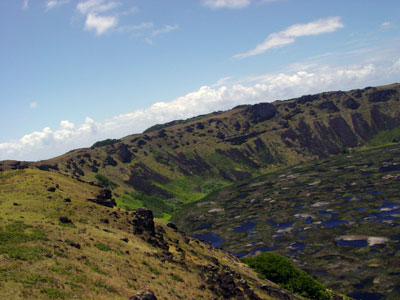
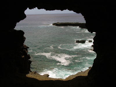
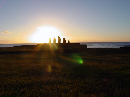
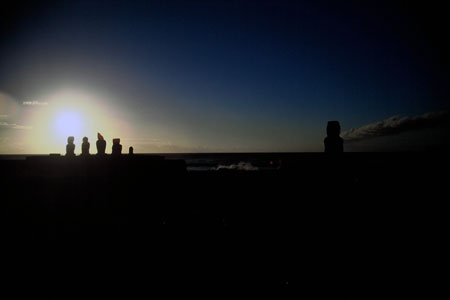
Awaking early with the sunrise, I find my room is overlooking the sea, with Rano Kau to my left, a half buried ahu in front and the ana tai kanata caves, down and to my right.
I have arrived on Easter Island.
Out and about
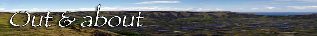
With a week on Easter Island, I decided I was able to take my time to visit the various areas.
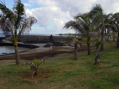
My first day was a self guided walking tour of Hangaroa. I had lunch in town and walked along the coastline and returned by way of the museum and the cemetary. My last visit of the day was the Ana Tai Kanata cave, as I was staying near there.
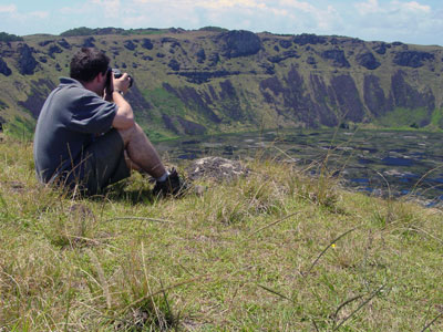
My second day was a days walk upto the village of Orongo on Rano Kao. I spent the entire day in this effort, partly by taking the time to descend into the crater and to walk out intot he reed beds in the crater lake. I higly recommend a large supply of water.
My third day I borrowed a bicycle and started to go further afield. Each day I branched out more and more. It is essential to take plenty of water, to wear a hat and sun protection cream.
I also made sure that I mostly went around the iland in a counter-clockwise direction. there was a very good reason for this, most of the tour groups go in a clockwise direction.
If you don't have a huge amount of time, do a tour on your first day and then with any time remaining, rent a bicycle or jeep and visit those places that interested you most.
I was on the island for over a week and had the luxury of being able to spend time at each site I wanted to visit.
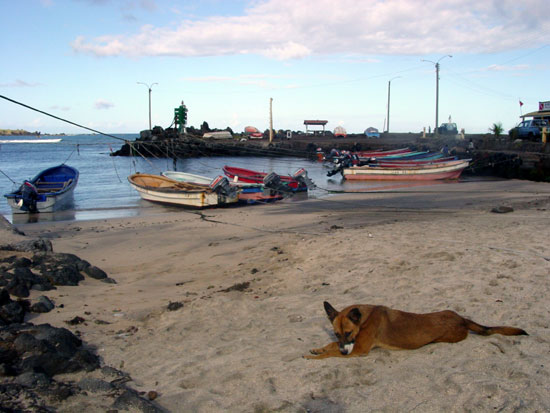
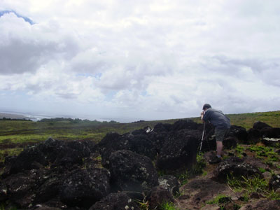
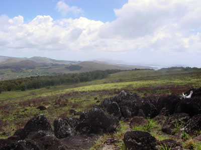
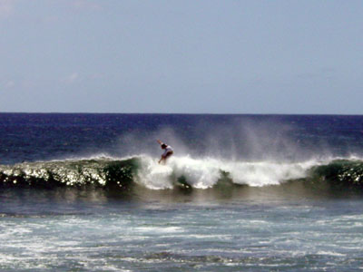
Fishing boats 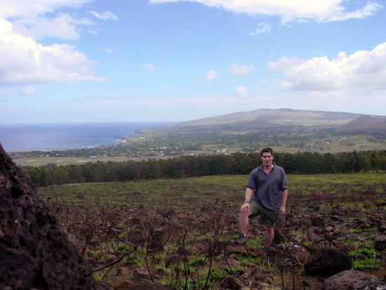
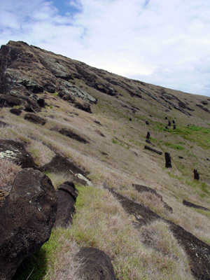
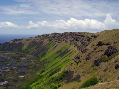
Climbing Rano Kao 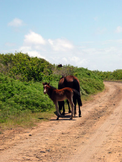
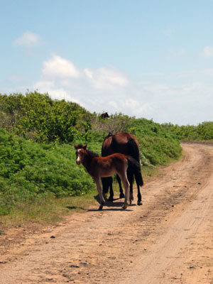
Roaming horses on Rano Kao 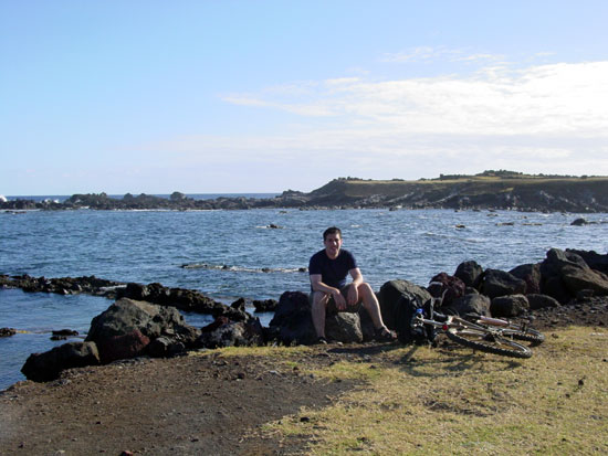
Taking a break from cycling 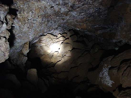
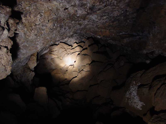
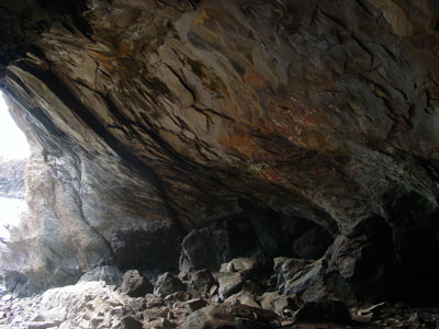
Underground in a lava tube
Thoughts on the history of Rapa Nui
What were they thinking?
Enveloping myself in the texts others have written, spending time with the artifacts of Rapa Nui, spending time exploring the island, I came to many conclusions based on what I saw. I came away with more questions than I arrived with and some opinions that may not be popular.
A history revised
We are also told that the moai were carved from the volcano Rano Raraku. Most, in fact were, but some, like Hoa Hakanani'a, were not. This is an example of revisionism by exclusion. The story and myth of Rapa Nui is easier to tell with only one birthplace of the moai.
The first moai
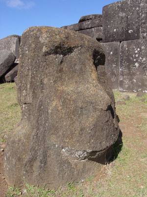
I first started to believe in this revisionism when I was filming a scene about the "first moai" on Rano Raraku. Even though the story of the first moai is certainly fable, there is probably an element of truth to it; that being this was an early attempt at carving a statue.
Casting your eyes over this reclined moai, you can just about make out the classical moai shape, though it is somewhat confused. Ears sort of melt into arms, the face is too big and not quite right, everything is eroded away so you just see the smooth and indistinct outline of the all the features. Legend has is that the sculptor responsible asked a friend for advice. Sleeping on it, the friend said "make the stature in my image". In other words; "make the statue in the shape of man".
It is to be noted that I have paraphrased the account of this story as written by Katherine Routledge and she wrote it from an account given to her at the turn of the 20th Century.
True or not, I believe this account important as it illustrates that the moai didn't just appear in a flash of inspiration, they were created over time.
Whilst I was having a personal revelation with this lump of volcanic tuff, a nearby tour group was being told about the moai with the carving of a boat upon its belly. I listened, interested in what the tour guide had to say. Apparently, this very rough and simplistic etching was a representation of the boats that the first settlers used to reach the island.
I was astonished at this explanation. Not only had I never read a single account suggesting this to be the case, just one look at the drawing should convince anybody of two things. Firstly, the boat looks like a European ship from the 1700s. Secondly, we know that whilst the people of Easter Island were creating moai, they were artistically talented. If boat etching on this moai were originally intended, then the quality would have been much higher and probably on the back. The etching is simple and crude, a sign, in my opinion, that it was not added for any significant purpose and that it could even be simple graffiti. Could it, for instance, have been drawn by an early European visitor to the island?
Religion
I also think that the distinction between the monolithic statue building era and the birdman cult are not as separate from each other as we are usually led to believe. The moai taken from the island by H.M.S Topaz was a ceremonial statue and was up in the village of Orongo which was inhabited for only a few months when the customs of choosing the birdman for the year were conducted. This implies either that the moai were still important in some way during the birdman cult (probable) or that the birdman cult was around in some form during the moai building era (less probable). Perhaps the birdman cult grew steadily over a period of time and brought with it aspects, such as the incredible stonemasonry, of the previous monolithic building era.
What were they thinking?
"What were they thinking?" a question that continually haunted me during my visit to Rapa Nui in the autumn of 2001. The obvious application of this question is to the building of the moai, but consider the construction of an ahu.
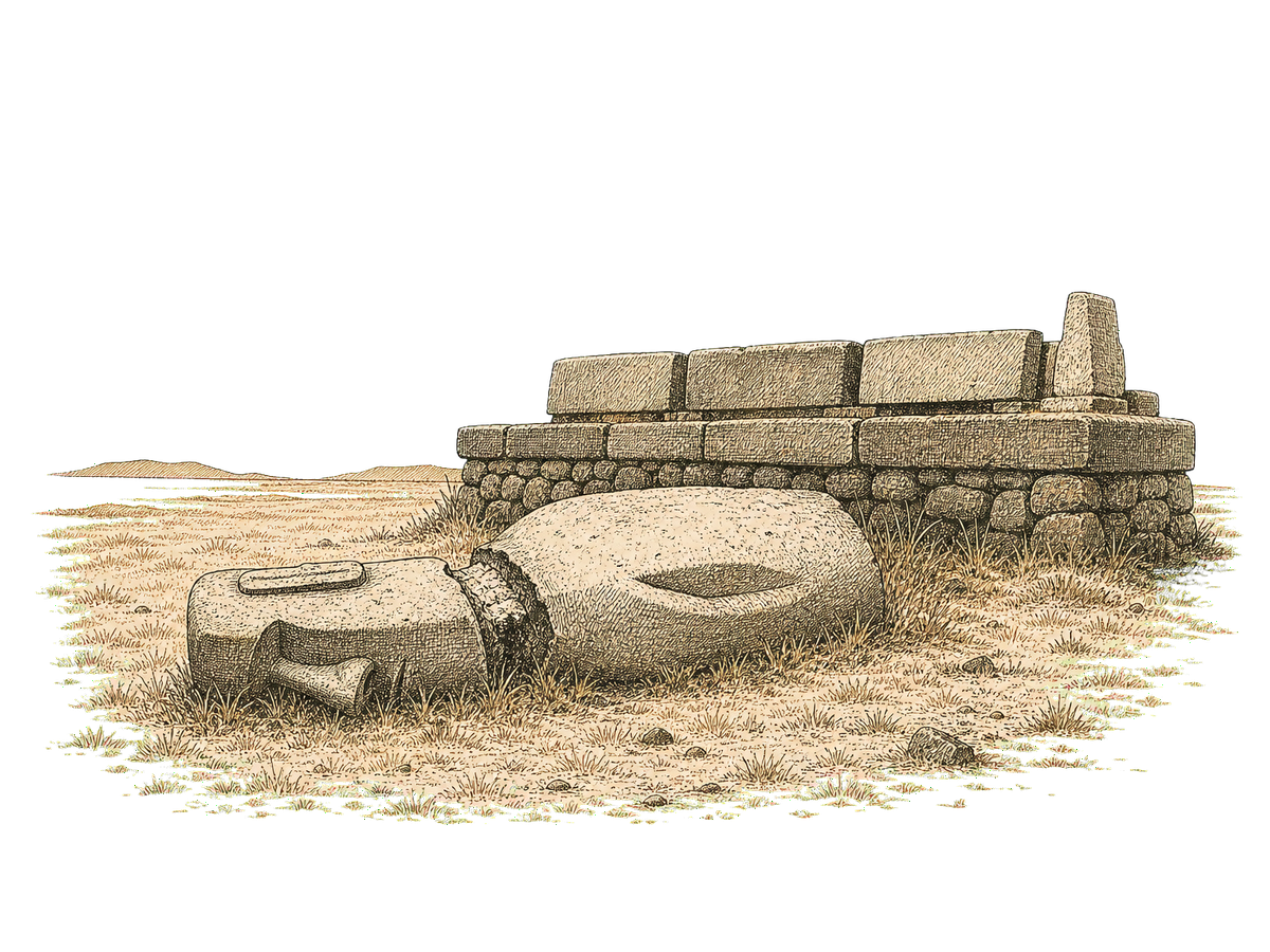
The core of the structure is filled with rubble, not roughly hewn lumps of rock dug out of the ground, but large rocks that are generally rounded and smooth.
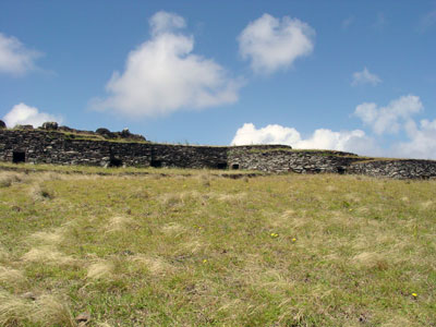
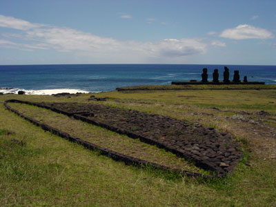
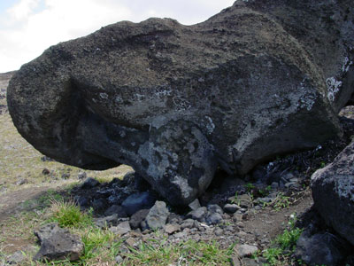
Okay, the first thought is they must have got the rocks from the shore. The problem with this is that there did not appear to be what I would call vast amounts of worn stones around the coast. Of course, this could simply be because they were either used in the construction of ahu, or have been washed away for some reason. The shear quantity of rock needed to build an ahu is staggering. There is the main platform itself and the burial vaults which form part or the structure tapering away from the main platform. In cross-section, the ahu looks like a door wedge with the thin end pointing away from the sea. How did they move such a vast quantity of stone? Probably through sheer brute force and time. My host, Maria Manutomatoma, grew up in the area around Rano Raraku where the majestic Ahu Tongariki stands. This ahu, according to Maria, was 20 meters in height and would have had 25 giant moai standing upon it before they were pulled down. I interpret this as 20 meters in height of the platform and the moai. In the 1960s the entire structure was literally flattened by a tsunami. Some of the fallen moai were sucked out to sea and probably rest close to shore to this day.
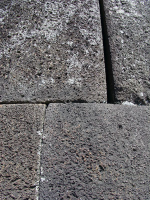
Then you have the question of the incredibly well worked cladding that many of the southerly ahu had. Ahu Vinapu is a fantastic example of the "Inca like" precision of the stonemasonry. Closer inspections of other nearby Ahu show that they too had been built with similar precision, though the elements have been unkind to these ahu. In their own right, the ahu are incredible structures and should cause archeologists sleepless nights working out how they were created.
Walking the moai
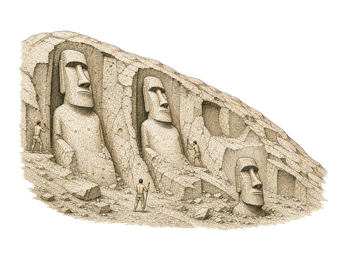
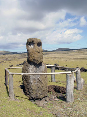
Much has been written about the carving of the Moai and how they could have been erected upon an ahu. In short, the Moai were carved out of Rano Raraku, lowered down the mountainside using ropes secured to the top of the mountain through huge islets carved into the rock. At least one of these is so big a child or a slim adult could snake into it and out the other side.
The first resting place of the Moai would have been a pit from which the fine detail of the Moai could be easily added.
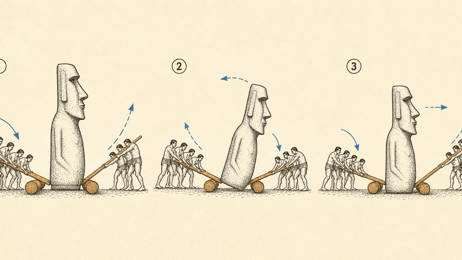
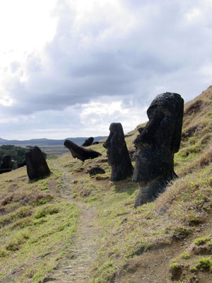
This is where things get a bit hazy. Folklore tells us that the Moai then "walked" to the ahu. How could this be possible? Well, it is possible and has been shown to be possible. However, showing something is possible does not prove that it was done that way. To make the Moai "walk" you place a tree trunk either side of the Moai. Now, get a few hefty wooden poles and go to one side. Use the tree trunk as a fulcrum and stick one end of your pole under the Moai and push down on the other end until the Moai starts to rise off the ground on one side. Now, pull back slightly on the pole in the same way as a rower might and the Moai will shift slightly forward. Repeat on the other side of the staure and you will create a "walking" or more accurately put, "waddling" Moai. This shows that the Moai could be moved in an upright manner, though how you get the thing safely up and down inclines and then finally onto the ahu, all the while standing, I don't know.
A more practical method of transportation would be to create a wooden sled and drag the whole thing horizontally to its ahu or standing place. Raising the Moai is remarkably easy. Stick your poles under one side of the moai and fill the gap with stones, Repeat on the other side. The moai is now slightly higher. Repeat until the Moai is raised. This has been shown to be straightforward and effective.
I would also like to point out that not all moai were created to stand upon ahu. Some were never, ever meant to leave Rano Raraku. These moai are either decoratively carved onto appropriate outcroppings of rock or have small bases. Moai can be found inland, apparently scattered. It is possibly that these Moai once stood sentinel along three ancient roads that fanned out from Rano Raraku. I also believe that the majority of Moai left in Rano Raraku were never seriously intended to stand upon ahu. I believe that as the Rapa Nui society spiraled into decline a rapid increase in the production and size of Moai happened. This was an attempt to appease the Gods in some way. Build ever-larger Moai and the Gods or ancestors would look favorably upon you. I do not think that the 65' giant Moai still in the side of Rano Raraku is unfinished. There is just no way society at that time could have got that Moai standing anywhere, let alone upon an Ahu.
Now, what about the pulling down of the Moai? Warring factions or planned destruction? Most of the fallen Moai seem to have been pulled down in the same direction (forward) and to have been left lying next to each other. I would have expected warring destruction to allow for a more disorderly aftermath or perhaps there was even at time of war, a ritualistic method for pulling the Moai down. Symbolically, did you pull them down forwards so that you quite literally rubbed your enemies ancestors noses in the dirt? Is it possible that an earlier tidal wave, though less brutal than the one in the 1960s, could have knocked down many of the Moai and is it possible this was the triggering of a shift to the birdman cult? I can't prove any of this, it is just the putting thoughts into words.
Finally, what of the writing of Rapa Nui? Is it real and just incredibly difficult to decipher due to the few number of rongorongo boards that have been preserved. Or, is it possible that the writing is just a random stream of glyphs that were created after seeing the writing of the first Europeans? I'm not sure about this one, I think both have good arguments behind them, but my quirky sense of fun would like to think that the writing is a fake and that somebody once thought, "this'll fox 'em!"
Conclusion
If we can answer the simple question of "What were they thinking?" then many of the mysteries of Rapa Nui will be solved. It is apparent that the revisionism of the history of Rapa Nui needs to be combated, both on the island with ill-informed tour guides and authors that are glib with the truth and thin on research (myself included). Finally, take nothing you read as absolute truth. Use it instead as a basis for making your own judgment after you make the unforgettable journey to "the land of giants".
The voyage through time
Three million years on one line. Keep scrolling; the line moves sideways.
Before people · 3,000,000 to 240,000 years ago
Poike erupts from the sea floor, the island's first corner.
Rano Kau follows at the opposite corner.
Terevaka's lavas knit the three volcanoes into one landmass: 69 miles square, alone in the Pacific.
The voyagers · 200 BC to AD 1200
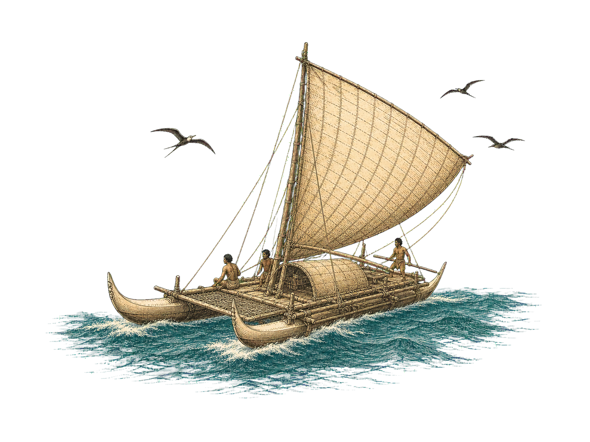
Polynesia begins to be settled.
Rapa Nui / Easter Island settled.
The revision: radiocarbon work since 2006 argues the canoes arrived nine centuries later than the old books said. The primer's own warning applies; take nothing as absolute truth.
The statue years · 600 to 1500
Ahu's at Vinapu and Tahai constructed.
Overuse of natural resources, deforestation underway.
The great carving period at Rano Raraku. Nearly nine hundred moai are cut from the tuff; almost four hundred never leave the quarry.
Collapse · 1500 to 1722
Intensive warfare, Moai construction ceasing, Birdman cult develops.
Natural resources failing, Birdman cult failing and cannibalism starts.
Contact · 1722 to 1862
Easter Sunday. Admiral Jacob Roggeveen (Dutch).
Gonzalez names Easter Island San Carlos (Spanish).
James Cook visists (British).
La Perouse (French). Occasional visits from passing ships follow.
New England whaler, The Nancy, kidnaps 22 islanders (USA).
Peruvian slave trades take in excess of 1000 islanders to work on the Peruvian Guano trade.
Mission and annexation · 1864 to 1897
(Jan.) Arrival of first missionary from Valparaiso.
Commercial exploitation begins with the arrival from Tahiti of M. Dutrou Bornier. Subsequently murdered by the local population who claimed he "fell from a horse".
H.M.S. Topaze removes two statues, later presenting Hoa Haka Nana Ia to Queen Victoria and the other to the British Museum. Both now held by the British Museum. The stolen moai, above.
Pierre Loti, L'Ile de Paques visits the island.
The census counts 111 people. After the raids and the epidemics, this is the island's lowest ebb.
Visit by the American warship Mohican. Annexed by Chile.
Mr. Merlot of Valparaiso leases the greater part of the Island and subsequently form a company for the "Exploitation of Easter Island".
The company years · 1897 to 1953
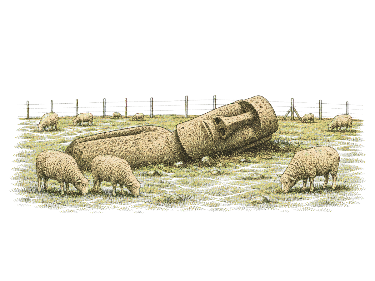
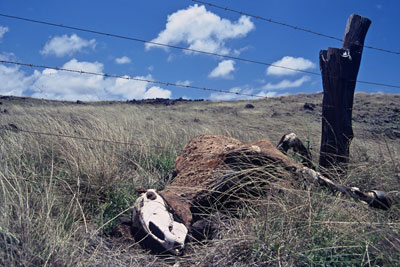
Williamson, Balfour & Company turn the island into a sheep ranch. The islanders are fenced into Hanga Roa; the sheep get the rest.
Katherine Routeledge visits for a yearlong expedition to the island. Publishes the book "The Mystery of Easter Island" in 1919.
Leased to private companies (some British influence?).
Archaeology arrives · 1955 to 1986
Thor Heyerdahl visits Easter Island.
22 May: the Valdivia earthquake, the largest ever recorded, sends a tsunami across the Pacific. It flattens Ahu Tongariki and drags moai out to sea.
Airport constructed, reliance on yearly Chilean Navy visits reduces.
Chile declares Easter Island a province.
Tahai restored by Mulloy.
Landing strip extended to allow Easter Island to be used as an emergency landing strip for the NASA Space Shuttle.
Restoration · 1992 to 2001
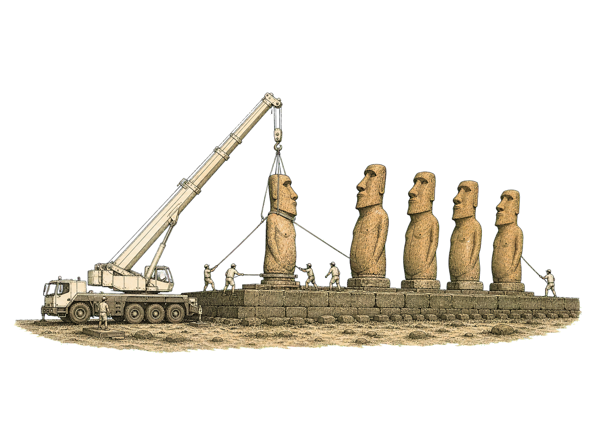
A Chilean and Japanese team re-erects the fifteen moai of Ahu Tongariki, the ones the 1960 wave threw down.
Hollywood arrives: Kevin Costner produces "Rapa Nui" on location. The reviews are unkind.
UNESCO lists Rapa Nui National Park as World Heritage.
Autumn: the author lands at Mataveri with nine days, a borrowed bicycle and a list of questions. The journey, above.
The present · 2007 to today
Chile amends its constitution: Easter Island becomes a "special territory".
The Rapa Nui marine protected area is declared, 720,000 square kilometres of ocean, among the largest on Earth.
A Rapa Nui delegation travels to London to ask the British Museum for Hoa Hakanani'a back. "You have our soul," the governor tells them. The statue is still in Bloomsbury.
The pandemic closes the island for over two years. The only flight today does not come.
October: a wildfire sweeps Rano Raraku and scorches the moai in the quarry.
A previously unknown moai is found in the dried-up bed of the Rano Raraku crater lake. The island is not finished talking.
Photographs
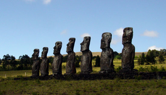
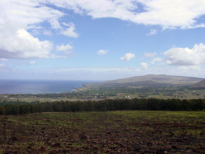
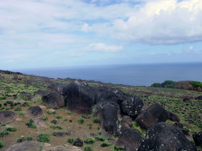
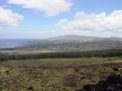
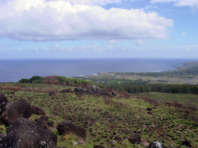
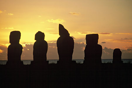
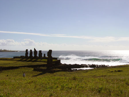
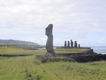
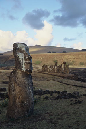
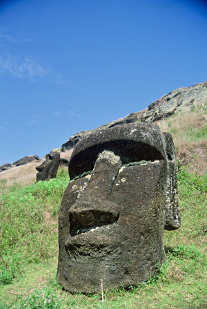
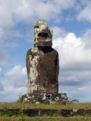
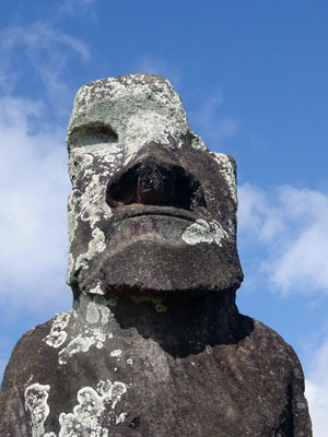
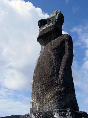
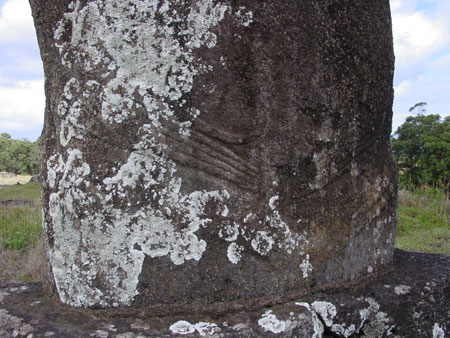
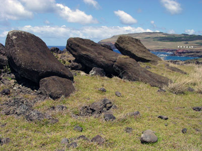
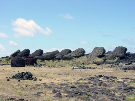
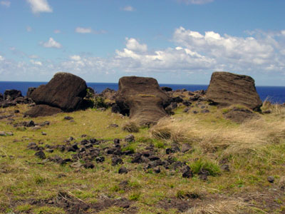
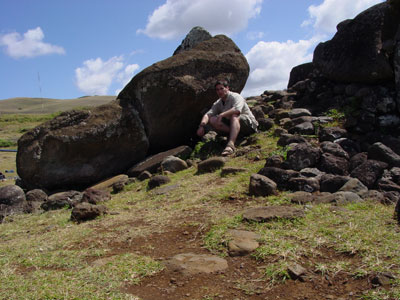
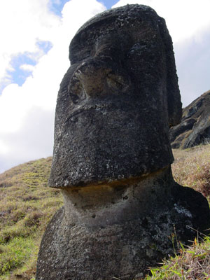
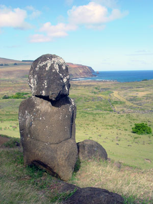
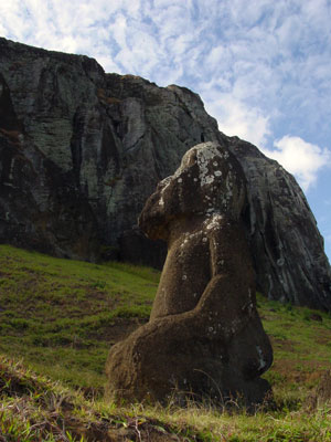
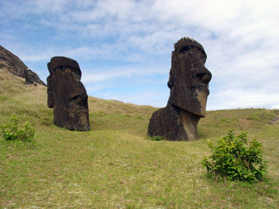
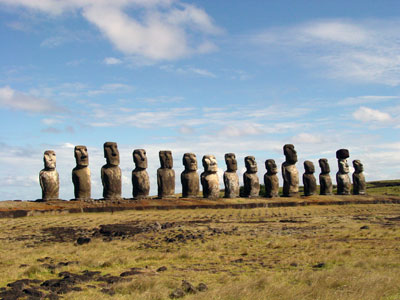
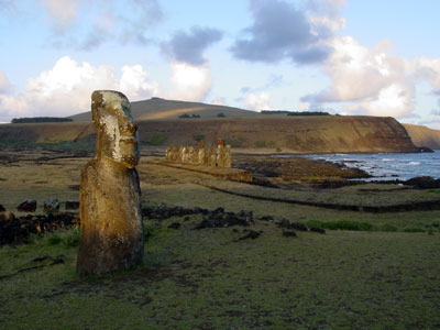
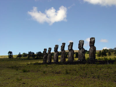
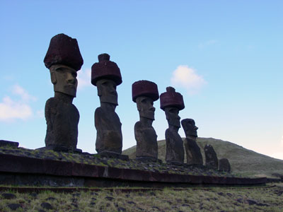
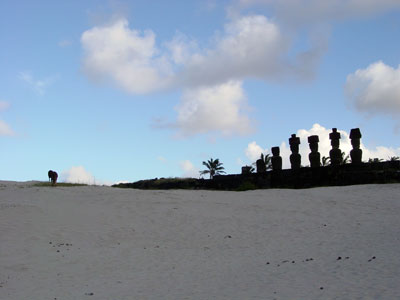
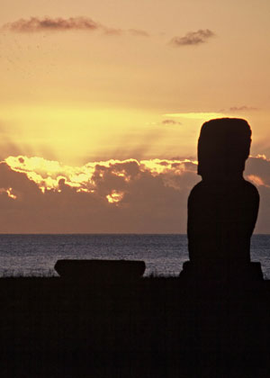
The island and its statues, autumn 2001
A selection of photographs from Easter Island. All images are copyrighted by Seamus Waldron and are not to be re-used.


Further reading
The shelf, refreshed June 2026
The original list was collected in 2003 and most of it has gone the way of GeoCities. Here is what is worth your time now, checked and current. The 2003 shelf survives, for the curious, in the archived page.
- Easter Island Statue ProjectJo Anne Van Tilburg's long-running survey of every moai on the island. The inventory the timeline's "nearly nine hundred" figure comes from.
- UNESCO: Rapa Nui National ParkThe World Heritage listing itself, with documents, maps and state-of-conservation reports since 1995.
- Hoa Hakanani'a at the British MuseumThe stolen friend's own catalogue entry. Compare it with the 2018 plea in the timeline.
- Museo Rapa NuiThe island's own museum in Hanga Roa, the Padre Sebastian Englert. In Spanish, worth it anyway.
- Terevaka Archaeological OutreachField school run with Rapa Nui students; two decades of reports and maps from the ground.
- Easter Island Rock ArtThe Bradshaw Foundation on petroglyphs and the birdman. Still the best single page on Orongo's carvings.
- Secrets of Easter Island (PBS/Nova)The 1998 programme that re-erected a moai to test the theories. A survivor from the original list.
- The Kon-Tiki Museum, OsloHeyerdahl's raft and his 1955 Rapa Nui expedition material, where this site's obsession began.
- Imagina Rapa NuiThe practical one: flights, lodgings, site opening hours and park tickets, kept current.
- Wikipedia: Easter IslandThe quickest overview, and far better sourced than it was in 2003.
On paper
- The Mystery of Easter Island Katherine Routledge · 1919
The yearlong 1914 expedition this page leans on, and still a remarkable read. Free at Project Gutenberg.
- Aku-Aku Thor Heyerdahl · 1957
The book that lit the fuse in the Charing Cross Road bookshops. Read it for the adventure, not the conclusions.
- Easter Island: Archaeology, Ecology and Culture Jo Anne Van Tilburg · 1994
The sober survey, from the woman who catalogued the statues.
- The Enigmas of Easter Island John Flenley & Paul Bahn · 2003
The pollen-core science behind the deforestation story told above.
- Collapse Jared Diamond · 2005
Made the island the world's favourite ecological parable. The next book disagrees.
- The Statues That Walked Terry Hunt & Carl Lipo · 2011
The revisionist case: later settlement, rats not recklessness, and moai that walked. The source of the timeline's c. 1200 entry, and an echo of this page's own advice: take nothing as absolute truth.
- Island at the End of the World Steven Roger Fischer · 2005
A full history by the rongorongo scholar quoted in chapter 03.