Tikal is the greatest of the Maya cities, a metropolis of stone pyramids that a thousand years of jungle could hide but not erase. Getting there is a slog through the Peten lowlands. It is worth every mile.
This is the guide Scott Cardwell wrote for A Profound Journey in 1996, lightly corrected and brought up to date, with a few sections added thirty years on. Scott’s account of the place and its people still stands. Seamus Waldron, 2026.
“It lay before us like a shattered bark in the midst of the ocean, her masts gone, her name effaced, her crew perished, and none to tell whence she came, to whom she belonged, how long on her voyage, or what caused her destruction.”
John Lloyd Stephens, 1842
Introduction
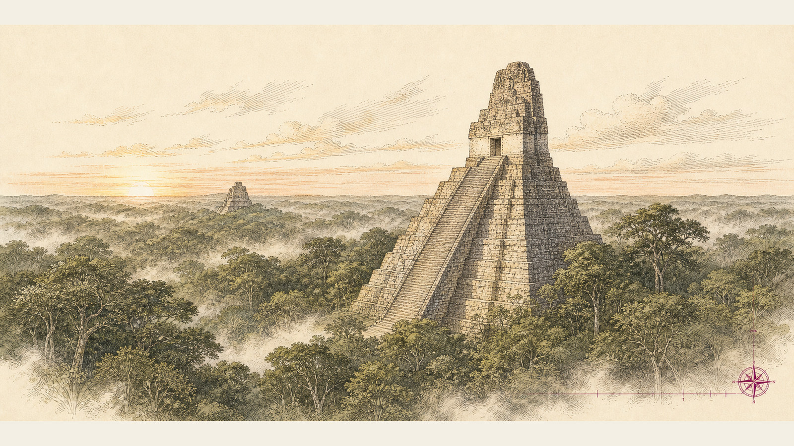
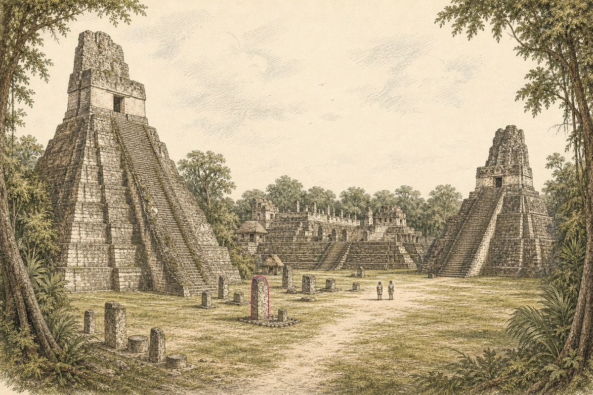
It is impossible to take the quarter-mile walk through the lowland rainforest that spills you into the middle of the Central Plaza of Tikal without feeling the same awe John Lloyd Stephens recorded at his first sight of a Maya ruin in 1842. The mute imperial glory of the temples, the majesty of giant mahoganies, all combine to an effect that is almost magical: pyramids in the middle of a rainforest. And, like all humans, standing in the Plaza or on top of a temple is not enough. We want to understand the lot of it: the people, their gods, and what drove them to build this place.
A century and a half of study has not yielded all the answers, but, as the following sketch shows, we have at least made it into the foyer of the house of knowledge.
Where is it?
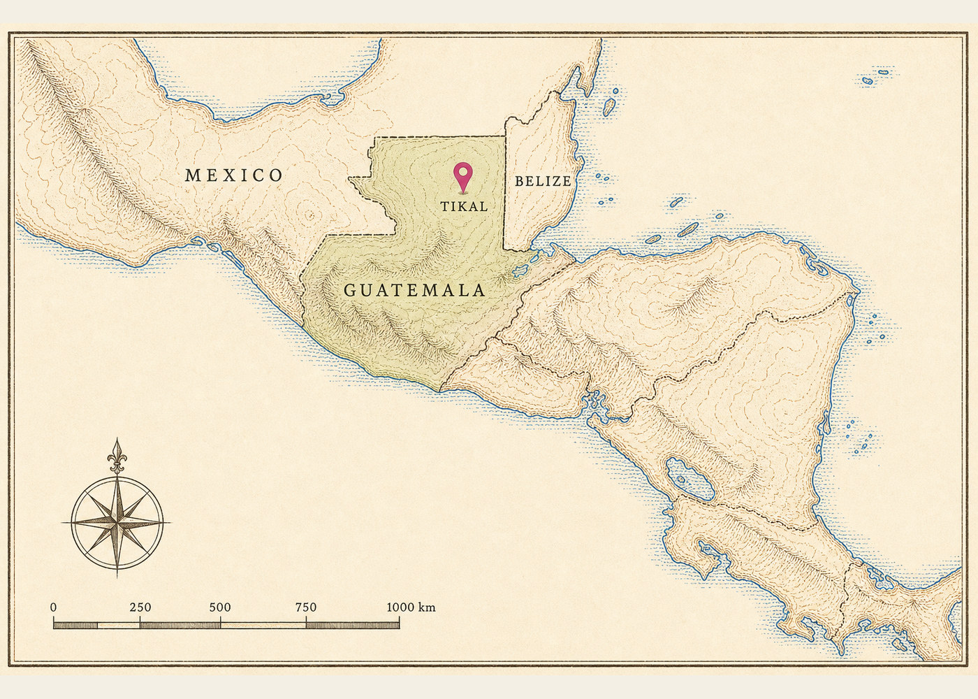
Tikal sits in the northeastern Peten, the lowland rainforest that fills the top third of Guatemala, in Central America. Mexico lies to the north and west, Belize to the east.
The basics
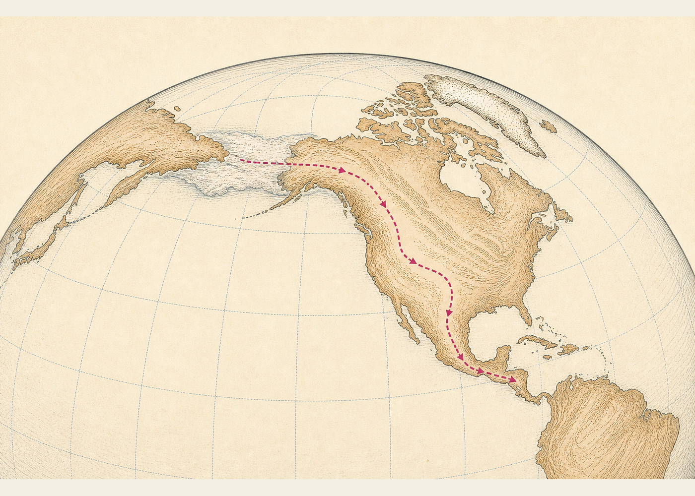
Sometime between 12,000 and 20,000 years ago, hunter-gatherers crossed the frozen Bering land bridge into the Americas. By the first millennium BC a complex culture called the Olmec had arisen in the Gulf lowlands of Mexico, building cities and carving two-tonne basalt heads. Around 600 BC some of these people found their way to the Peten jungle of lowland Guatemala, where they began what would be more than 1,100 years of ceaseless construction on the site we know as Tikal, a name whose original meaning is lost to us.
At its height, Tikal was home to tens of thousands of people and sprawled across more than 20 square miles. Sometime in the ninth century, for what is now thought to be a combination of cultural and environmental reasons, the city was abandoned to the jungle. The last date carved into its monuments reads 869 AD.
Locals always knew the ruins were there, but Tikal was not officially “rediscovered” until 1848, when an expedition from the Peten government reached the site. They found temples, palaces and pyramids under a thousand years of tropical growth: 200-foot temples capped with 175-foot trees. In the twentieth century, large excavations and reconstructions were undertaken jointly by the Guatemalan government and several US universities. Even now, only a fraction of the city has been freed from its living tomb.
In recent decades, dramatic breakthroughs in reading the rotund and sometimes menacing Mayan glyphs have given us, from the once-mute monuments, a culture of kings and queens and priests and blood, of ritualised warfare between rival city-states, of vast construction and sudden desertion, of astronomical and mathematical knowledge to rival anything in the ancient world, Old or New.
Why the Classic Maya cities were abandoned at the end of the first millennium is still not fully understood. The leading theories point to some mix of environmental exhaustion, revolt, famine and the failure of a priesthood that had promised more than the gods delivered. And, contrary to a stubborn pseudo-science rumour, the Maya did not vanish. They moved to the highlands, where, after five centuries of conquest and colonial rule, they still weave their own cloth and keep the old rituals.
In 1996, peace accords ended a 36-year civil war that had killed or disappeared more than 200,000 people, the overwhelming majority of them Maya. Out of that peace grew what was hopefully called a Mayan renaissance: the Indigenous Maya, who make up something like four in ten Guatemalans, beginning to take a fairer share in the country’s government and schooling for the first time since the Conquest. Thirty years on, that promise has been only partly kept, but the war, at least, is over.
And while the living work towards a long-sought voice, each day a little more is decoded, unearthed and understood about the magnificent city of the jungle.
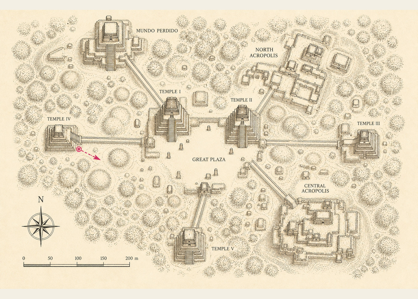
Ruins map
Tikal National Park covers 222 square miles of northeastern Guatemala. About 20 square miles of ruins have been mapped. From the top of any of the taller structures you can see tree-covered hillocks stretching in every direction. Those are unexcavated ruins.
Getting there and when to go
In 1996 the standard approach was a long haul up from the south. Today most visitors fly into Flores, on Lake Peten Itza, served by Mundo Maya International airport, and drive the hour or so north to the park. The other clean route is overland from Belize: cross at Benque Viejo del Carmen into Melchor de Mencos and carry on west. If you are already in Belize, Tikal is an easy two or three days bolted onto the trip, which is how a lot of people see it.
The dry season runs roughly from late November to April and is the comfortable time to go. The rains from May onward turn the tracks to soup, though the jungle is at its loudest and greenest then if you do not mind a soaking.
One practical note that has changed since Scott wrote this. You can no longer scramble up every temple. Temple I is off limits, and several others are climbed by fixed wooden staircases rather than by hauling yourself up the stone. Temple IV, the tallest, still has a stair to the top, and the view from it is the one to plan your day around.
Pith and particulars
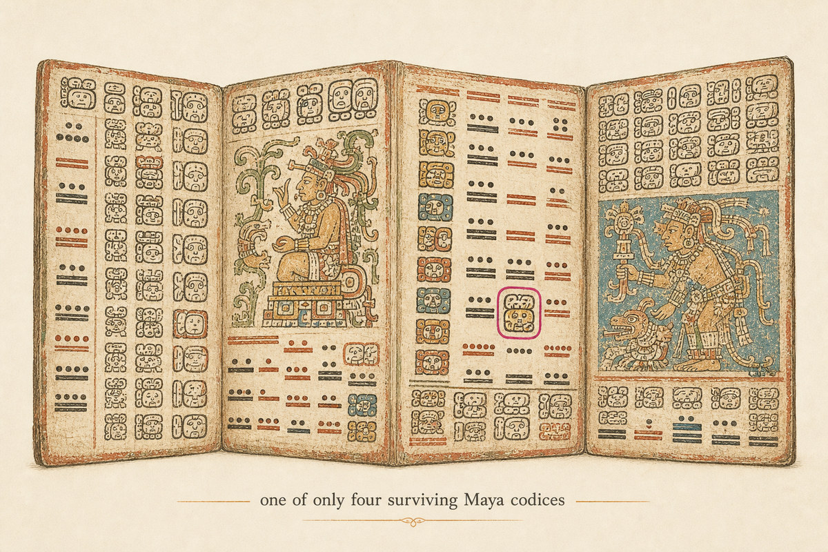
- The Maya made books from bark paper, recording astronomical and historical data. These books are called codices. Only four are now thought to survive, three of them in European libraries; most of the rest were burned by Spanish priests after the Conquest.
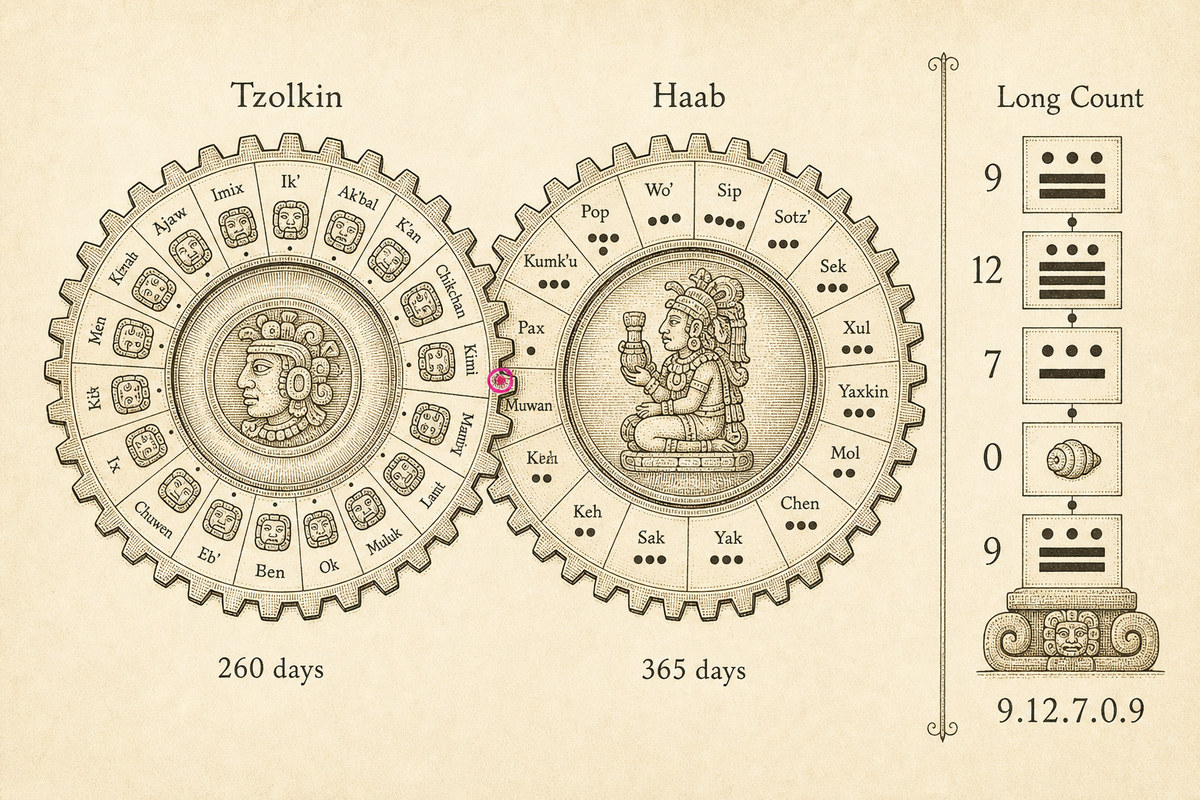
- The Maya kept a complex calendar, still observed today in many Maya communities.
- Two cycles of time, a 260-day cycle and a 365-day solar year, ran at once.
- The 260-day cycle is a ritual almanac: 20 named days (the names of gods) and 13 numbers, the exact pairing repeating every 260 days. Birth dates were read from it and important events timed by it. Time and religion were inseparable.
- The solar calendar had 18 months of 20 days, plus five additional days of bad luck at the end of the year.
- Together they make a 52-year period, the time it takes for a given day to come round again. This is the Calendar Round.
- The Calendar Round sits inside a longer system, the Long Count, which measures time from a fixed starting point corresponding to 13 August 3114 BC. The meaning of that date is unknown, but thought to be mythological.
- Long Count dates group days as follows: baktun (144,000 days, or 20 katuns), katun (7,200 days, or 20 tuns), tun (360 days, or 18 uinals), uinal (20 days, or kins), kin (one day). A date written 9.12.7.0.9 reads left to right: 9 baktuns, 12 katuns, 7 tuns, 0 uinals, 9 kins, counted from the beginning of time.
- The most important buildings were aligned to astronomical events: the equinoxes, the summer solstice, the rising of certain planets.
- The Maya tracked and predicted Mars, Venus, Mercury and Jupiter.
- They were using a symbol for zero by at least the first century BC.
- The temples, white today, were originally painted in reds, blues, greens and yellows. If a dye existed, it went on the walls.
- They used no metal tools in any of their building or carving. Obsidian and jade did the cutting.
- More than twenty Mayan languages are spoken in Guatemala today, alongside Spanish, Xinca and Garifuna.
One more, added with the benefit of hindsight. The current Long Count cycle, the thirteenth baktun, ran out on 21 December 2012. A small industry grew up around it predicting the end of the world. The world, as the Maya themselves would have told you, simply rolled over into the next cycle and carried on.
Natural phenomena
Critters
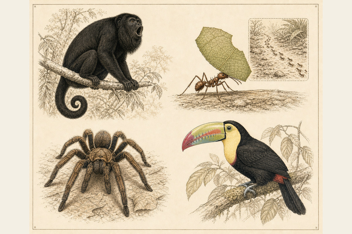
The rainforest that has swallowed the monuments is full of life. For instance:
- Tarantulas, big hairy spiders with a leg span up to ten inches. Females have survived more than two years without food and live over twenty. Males die quicker. Go figure. The bite of either is not particularly harmful to humans, though, ick, best avoided.
- Leaf-cutter ants march in their thousands to a tree, wearing a path inches deep into the forest floor. Each ant cuts a leaf section several times its own weight and carries it home, sometimes a mile away. At the nest they chew the leaves to a pulp where a fungus grows, then harvest the fungus to feed the colony. Too dry, and they leave the cuttings out overnight to take up moisture; too wet, and they put them out in the day; soaked, and they throw them out and start again. These insects are farmers.
- The black howler monkey, moving through the trees more like a cat than a swinging ape, lives in groups of up to ten and marks its territory with a howl, part primate, part lion, that carries up to 3 km. Helpful hint: do not stand underneath. They enjoy soiling the tourists.
- More than 200 species of birds make this some of the best birding in the world.
Vegetable matter
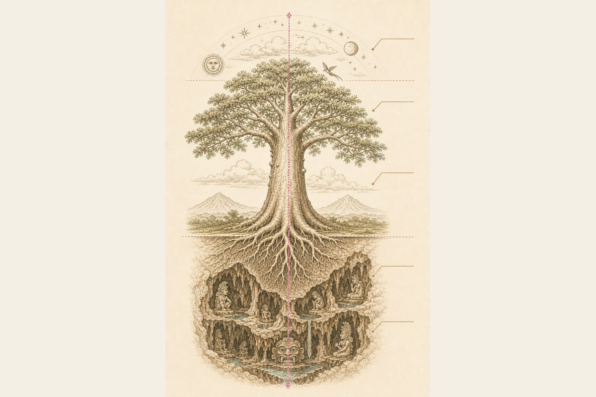
Among the mahoganies and cedars, many over 200 feet tall, stands the giant, sacred ceiba, which in the Maya view stands at the centre of the world and binds the universe together. Its roots reach down into the Underworld; its trunk rises from the heart of the earth into the heavens.
Must do it
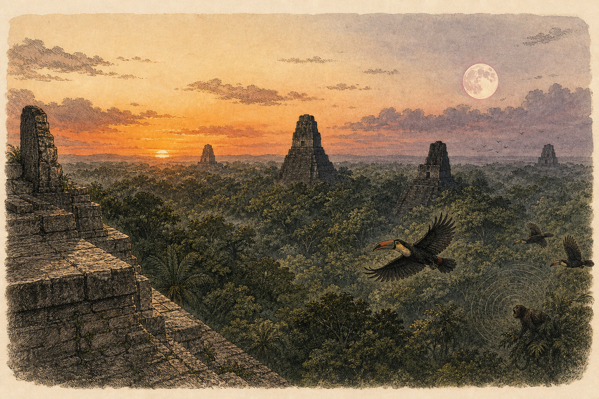
- Temple IV, at 230 feet, gives the best view of the other temples standing as quiet sentinels above the forest. Tree-covered hillocks nearby mark unexcavated ruins. Sunset is wonderful any day, but if you can, go on the full moon, which rises as the sun sets. Sitting on top of the temple with the moon coming up, the sun going down, monkeys howling and toucans crossing below, “almost magical” feels like an understatement.
- Get to Temple III in the dark before daybreak, sit, listen, and watch the jungle wake and the sun come up over the Central Plaza.
Thirty years on
Scott wrote this in 1996, with the war just ended and the calendar’s famous deadline still sixteen years off. Both have since passed into history. The temples have not. They stood here a thousand years before either of us, indifferent to our deadlines, and they will be standing long after this page has gone the way of the codices. That is most of the appeal. You go to feel small for an afternoon, on top of a pyramid, with the forest doing its level best to take it all back.
Key facts
- Country: Guatemala, in the northeastern Peten
- Nearest town and airport: Flores, with Mundo Maya International about an hour south
- Overland from Belize: via the Benque Viejo and Melchor de Mencos border
- Tallest structure: Temple IV, around 230 feet (70 m)
- Best time to visit: the dry season, late November to April
- Status: UNESCO World Heritage Site since 1979; a national park of 222 square miles
Original text by Scott Cardwell, 1996. Revised and expanded by Seamus Waldron, 2026.